Day 4 - Patterdale to Shap
Comment: 16 miles - Thrilling hike - my first true 'peak'
With another daunting day ahead of us we decided on a
significant change to the course between Patterdale and Shap,
involving a boat trip on Ullswater followed by quite a long but
mainly flat walk. However, talking with some other walkers at
breakfast, we found that we could join the coast-to-coast path
from our accomodation a few miles along the route. This convinced
us it was worth 'going for it', and soon we were booting-up ready
for another early-morning climb to lofty heights.
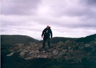
| Around mid-day, we were walking higher than we had
been so far on the walk. The wind was howling around us,
so much so that we were often forced to stagger along
leaning steeply into the winds. The forecast was for 50
mph gusts. The path was fairly broad, but as we
approached the top of Kidsty Pike, there were severe
drops on both sides. It was on this section that we
encountered Ian again, who we had met on the first day.
It was good to catch up with news, but conversation was
difficult due to the winds. After a while he left us well
behind. |
 |
 |
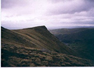
On approaching the peak our enthusiasm gathered pace.
Thank goodness we had decided to attempt today's hike as
I certainly wouldn't have missed this day for the world,
as it was a truly invigourating experience. The strong
and gusty wind whipped at my maps as I searched for the
route ahead. Kidsty Pike is over 2500 ft high with
dramatic views all around. We stayed as long as we could,
but we knew there was some way to go and the wind was
cold. We decided to start our way down towards
Haweswater, and have some of our packed lunch in the
shelter of the hillside. |
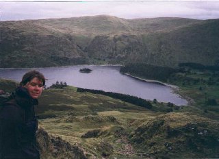
| The views of the reservoir below were fantastic.
Beyond the hills we could see way into the distance - and
to the cement-works at Shap - our destination for the
day. We clearly had a long way to go, but seeing
Haweswater below we could almost trace out our route
along its edge and around the hills - it looked quite
flat from here. The route around the reservoir to the
left was reasonably flat. The path was quite hazardous,
due to the loose stones and obvious land-slippage down
towards the water. I found out later that it is possible
to take the right-hand path around - which includes a
stretch along a road, and a pub overlooking the water.
After rounding the eastern tip of Haweswater, the
walking was reasonably easy. Eventually we found Shap,
and the pub where we were due to stay the night.
|
 |
Once again we were convinced we would not make it through next
day and again made plans over dinner for taking a bus.
Back to map

timr@timandtim.co.uk
Copyright © 2000 Tim Reeves