Day 7 - Keld to Reeth
Comment: 12 miles - We took the riverside path to avoid
another climb
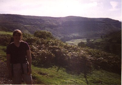
After going over the maps with Ian and chatting to the couple
who looked after us, we decided not to follow the Wainwright
route for this day. The 'official' path starts with a stiff climb
to achieve views of surrounding hill. We had seen enough hills
for the time-being and decided the riverside path to Reeth
sounded like a nice change.
 |
Again we regretted having only the strip-maps for the
Coast-to-Coast walk, as we were once again completely
without maps for this route. However, we were assurred
that the route was simple, and largely followed the
river. In fact it was a lovely day, and the pains in our
feet were turning to dull thudding, rather than sharp
stabbing. I think we could now regard ourselves as true
walkers. |
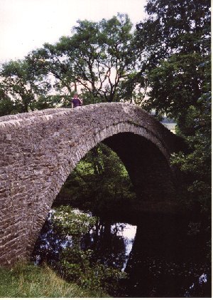
| We say on a bench next to a beautiful old bridge and
ate our sandwiches. The sun was once again shining and
everything was going well. This is true yorkshire
countryside, and the changes in surroundings were quite
dramatic. We passed villages along the river Swale, and
had a refreshing beverage in a pub at Gunnerside. The
riverside walk was reasonably easy, although the distance
is not inconsiderable. Sometimes we were right on the
banks of the river, with white-water cascading over rocks
on the riverbed. At other times we were looking down from
above, with the river obscured behind trees.
|
 |
We were quite fatigued by the middle of the afternoon, and
each village we approached we hoped it was Reeth. We had no way
of telling how far there was to go, but eventually we arrived in
Reeth's distinctive centre - a square of green surrounded by
shops, houses and pubs. A very pleasant little village.
Back to map

timr@timandtim.co.uk
Copyright © 2000 Tim Reeves